

San Pablo Bay National Wildlife Refuge provides numerous recreation opportunities that includes wildlife viewing, wildlife photography, hiking, boating, fishing, and hunting. Regulation of these recreation activities allow for public enjoyment of the refuge while still protecting the wildlife and habitats.
San Pablo Bay National Wildlife Refuge is open year-round during daylight hours. Check with the refuge office for the latest update on trail closures, wildlife concerns, maintenance and management activities.
Although you’ll spot mallards, black-necked stilts, herons and egrets year-round at the refuge, from November to January an influx of migrants, including diving ducks and shorebirds, make it a must-see for avid birders. Fortunately great care was taken in developing the area, and as a result there are a number of accessible trails and overlooks for wheelchair-users and slow walkers.
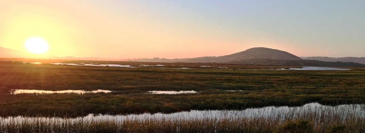
Tolay Creek/Lower Tubbs Trail: The parking lot is located 0.65 mile east of Highway 37/121 intersection. From the parking lot, this trail follows along the Tolay Creek for 2.5 miles before reaching Lower Tubbs Island. The trail once circled Lower Tubbs Island, however, during the 2014 South Napa Quake, breeches were formed in the levee making two sections of Lower Tubbs impassable. Once you reach Lower Tubbs Island, the trail offers beautiful views of salt marsh habitat and San Pablo Bay. This is one of the few places in the San Francisco Bay Area where one can feel remote from the hustle and bustle of a metropolitan area. Wildlife observation and photography are encouraged. Please stay out of closed areas to minimize disturbance to plants and animals.
Cullinan Ranch Trail: The parking lot is located 3.4 miles west of Mare Island on Highway 37. From the parking lot, the trail goes north for 1.3 miles until you reach South Slough. The trail offers views of Cullinan Ranch to the east and CDFW Pond 1 to the west. Both areas may have numerous waterfowl and shorebirds foraging and resting.
Heading west on Highway 37, Cullinan Ranch is the first San Pablo Bay site you’ll reach. That said, since there’s a median across the highway, it’s not possible to access this site if you are traveling east.
There’s accessible parking in the small lot, with level access over to the trail. The 1.3-mile hard-packed dirt trail leads past two former salt ponds to a viewing area at the end. Along the way you’ll see shell remnants from feasting gulls, ducks in the water on both sides, and sandpiper flocks along the shore.
There’s also an accessible porta-potty and an accessible kayak launch near the parking lot, and a nice overlook near the beginning of the trail. And although there are no picnic tables at this site, there’s a bench at the first overlook that makes for a good lunch stop.
Sears Point: The parking lot is located at 7699 Reclamation Road in Sonoma. This parking lot allows for access to four trails:
The final San Pablo Bay Refuge site is located at the intersection of Highway 37 and Lakeville Highway, just south of the Sonoma Raceway. Not only does this stop offer a nice variety of habitats, but it also boasts four wheelchair-accessible trails.
A quarter-mile hard-packed dirt and asphalt trail leads from the accessible parking spot to the trailheads. The Sears Point Trail begins on the left, just before you hit the park road. This 1.25-mile trail flanks a meadow which is an especially attractive habitat for herons and egrets. Several benches are located along the way, and if the trail is too bumpy you can always walk or roll along the seldom used paved park road.
Alternatively you can also explore the three levee-top trails across the park road from the beginning of the Sears Point Trail. Just follow the asphalt trail past the accessible porta-potty and over the railroad tracks. The path winds around the corner and then gradually climbs to the top of the levee. To the left is the Elliott Trail, to the right is the Sonoma Baylands Trail, and straight ahead is the Dickson Trail.
The 2.5-mile Elliot Trail and the 1.4-mile Sonoma Baylands Trail both offer bay and agricultural habitats, while the .3-mile Dickson Trail also gives folks a glimpse of the San Francisco Skyline in the distance. All three trails are level, and offer a hard-packed dirt surface. No matter which San Pablo Bay trail you choose, you won’t be disappointed, as the avian life is plentiful at all of the sites.
BOATING
Boat access to the open water and navigable sloughs of San Pablo Bay provides opportunities for fishing, wildlife observation, and wildlife photography on the refuge. There are no motorized boat ramps on the refuge. Ramps are available at the Vallejo public marina near Brinkmans marine and at Port Sonoma near the Petaluma River.
Vista Point
Vista Point is located a short drive west of Cullinan Ranch; however it’s only accessible if you are traveling east on highway 37. There’s accessible parking in the small lot, and a 400-foot paved level path leads out to an overlook. Interpretive plaques dot this site, which borders a nice section of wetlands.
A hard-packed dirt path leads over to another viewpoint which overlooks a patch of agricultural land. The trail is just 150-feet long, and there are some ruts along the way, so it might not be doable for some wheelchair-users.
There are no restrooms or other facilities at this stop, and it’s easy to miss, as signage is minimal. Still it’s a pleasant spot to sit and watch the avian life; and although there are no picnic tables, there’s a comfortable bench on the overlook.

